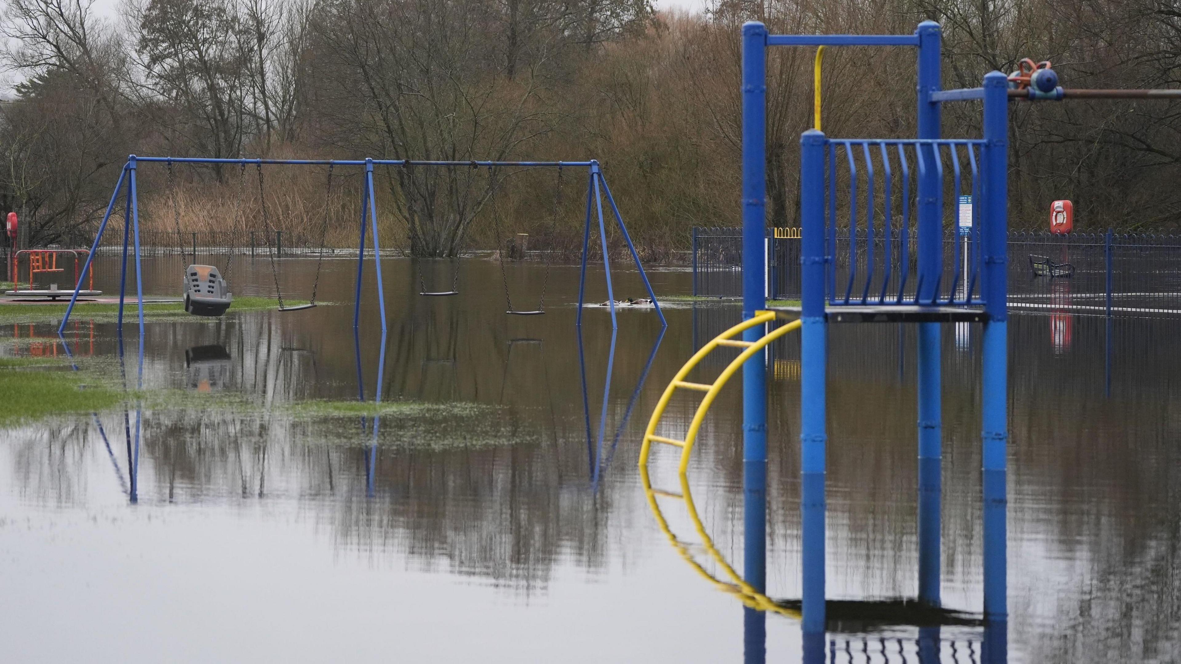
England is grappling with a deluge of flood warnings as days of relentless rain continue to saturate the landscape. As of Sunday morning, the Environment Agency has issued 90 flood warnings and 234 alerts across the country, signaling imminent risks to homes, roads, and communities. This wave of wet weather marks one of the most disruptive starts to the year, with the south-west and Midlands bearing the brunt of the downpours.
Current Flood Warnings: Where and Why
The majority of the warnings are concentrated in vulnerable areas prone to waterlogging. Devon and Hampshire stand out as hotspots, with clusters of alerts along riverbanks and coastal zones. Between Gloucester and Worcester, elevated river levels are causing particular concern, while Warwickshire Fire and Rescue Service has issued stark advisories that flooding is 'imminent' along the River Dene due to heavy, prolonged rainfall.
Beyond these focal points, more than 230 flood alerts are scattered across much of England, excluding the far north and East Anglia. In Shropshire, a dramatic incident unfolded on Friday when an Asda delivery van became submerged at Walfords Bridge, though fortunately, no one was trapped inside. These alerts serve as a precautionary measure, urging residents to stay vigilant as water levels rise rapidly.
Scotland has just one active flood warning, while Wales reports none at present. However, the interconnected nature of UK weather means the situation could evolve quickly, especially with rain forecast to persist through the weekend and into the new week.
Affected Regions in Detail
In the south-west, rivers like the Exe and Torridge in Devon are swelling, threatening low-lying farmlands and villages. Hampshire's Test Valley faces similar perils, with historical flood zones on high alert. The Midlands, particularly around Worcestershire and Gloucestershire, see the River Severn at critical levels, a river notorious for its seasonal overflows.
Local authorities are mobilizing sandbags and evacuation plans, but the sheer volume of alerts is stretching resources thin. Commuters and farmers alike are advised to check live updates from the Environment Agency's flood map for real-time information.
Behind the Downpours: A Record-Breaking Wet Spell
The Met Office attributes this crisis to an unusually persistent Atlantic weather pattern, delivering rain without respite. In south-west England and South Wales, precipitation has fallen every single day of 2026 so far— that's over 50% more rainfall than the seasonal average. January alone saw three named storms batter the UK: Ingrid, Goretti, and the most recent, Chandra, which last week brought gale-force winds, heavy rain, and widespread disruption.
Storm Chandra, in particular, forced dozens of schools to close and snarled transport networks with flooded roads and rail delays. Provisional data reveals that Northern Ireland endured its wettest January in 149 years, while County Down and Cornwall shattered local records. February has been no kinder; some regions, like Aberdeenshire, have already received over 130% of their typical monthly rainfall in just the first five days. Aboyne, for instance, recorded amounts that would normally span an entire month.
University researchers have noted this as potentially the longest spell of consecutive rainy days since 1908, underscoring a troubling trend in UK weather patterns. Climate experts point to warming oceans fueling more intense storms, raising questions about long-term resilience in flood-prone areas.
Impacts on Daily Life and Economy
The human toll is mounting. In addition to the Shropshire van incident, reports of isolated properties and disrupted power supplies are emerging. Travel chaos is rife, with major roads like the A38 in Devon closed temporarily and train services between Birmingham and Worcester facing cancellations. Agriculture suffers too, as saturated soils drown crops and livestock, potentially hiking food prices later in the year.
Businesses in affected towns report losses from inaccessible premises, and emergency services are on high alert for rescues. The psychological strain on communities, already weary from repeated storms, cannot be understated—many residents express frustration over what feels like an unending siege of water.
What's Next? Forecasts and Preparation
The Met Office predicts no immediate let-up, with bands of rain sweeping across England through Monday. While a brief respite might arrive mid-week, the overall outlook remains unsettled, with yellow weather warnings for rain in place for several counties. Temperatures will hover around average, but the saturated ground amplifies flood risks even from moderate showers.
To mitigate dangers, experts recommend avoiding low-lying areas, securing outdoor items, and having an emergency kit ready. The government has urged local councils to accelerate flood defense projects, but critics argue that infrastructure upgrades lag behind the escalating threats posed by climate change.
Broader Implications for the UK
This episode highlights the UK's vulnerability to extreme weather. With provisional data showing some spots receiving a full month's rain in days, it prompts urgent discussions on adaptation strategies. Environmental groups call for greener urban planning, like increased wetland restoration, to absorb excess water. Meanwhile, insurers brace for a surge in claims, echoing the billions in damages from previous floods.
As the nation navigates this watery ordeal, solidarity among communities shines through—neighbors helping with sandbagging and local charities distributing aid. Yet, the core message from authorities is clear: stay informed, stay safe, and prepare for more rain ahead.
In summary, England's flood warnings underscore a nation under water's grip, driven by a stormy start to 2026. With 90 warnings active and counting, the coming days will test resilience across the board. For the latest developments, monitor official sources and heed evacuation orders promptly.

